Category: The Edible Map project: promoting urban agriculturePage 2 of 2
I have been developing the Edible Mapping Project since 2010. The project combines map making, artist-led walks, costumes, and performance as well as initiating urban agriculture projects such as the growing of wheat in Newcastle.
The drawn maps are located in Croydon (2009), Hackney, east London (2010, 2011), Peterborough (2015), Newcastle (2015/ 2018), and Dallas (2015), and Domiz refugee camp (2019).
I argue that these maps help visualise the potential for local food production within typical urban spaces such as rooftops, car parks, grassed spaces, and vacant lots. Often, I use these maps to take people on walks around the neighbourhood to develop discussions in situ about how we might innovate everyday urban spaces to incorporate food production.
Below you will find greater detail about several of these projects, a gallery of maps as well as the costumes that are used to bring everyday urban food production to life.

Guardian 2011 Edible Hackney More and more people are finding imaginative places for growing food in urban environments. Edward Platt reports. The Guardian article is here

This page explores the Edible Map of Dallas, which covers 110 acres of central Dallas. The map explores the potential for urban agriculture in the neighbourhood, imaging food…

The edible Map project has been an ongoing since 2010. The project aims to collect spatial data on urban land that could be made available to grow food….

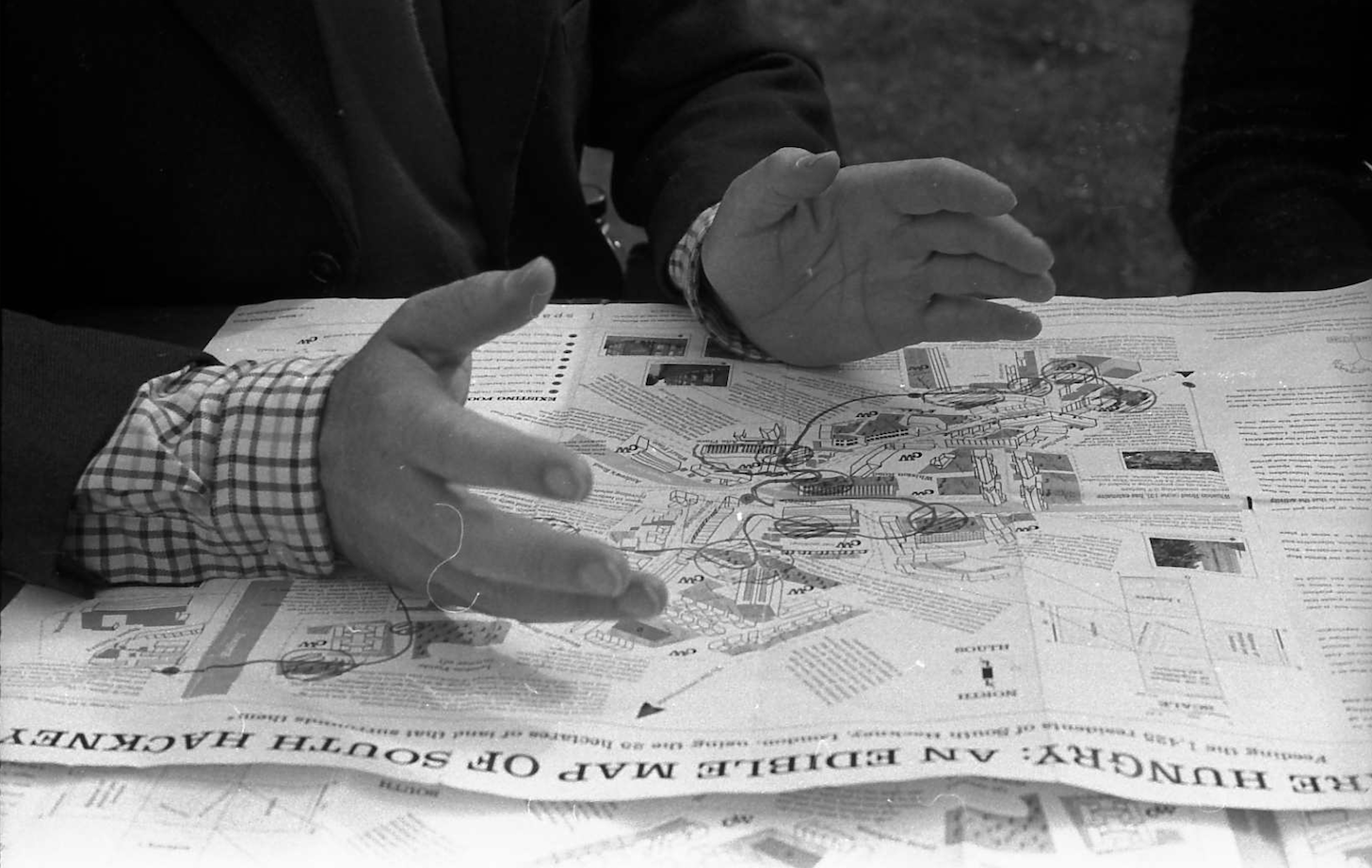
YOU ARE HUNGRY: MAPPING AN EDIBLE URBAN HACKNEY was the first Edible Map and walk that I created. The walks ran in both 2010 and 2011 and were…
As part of the Discovering Britain series, The Royal Geographical Society (with the Institute of British Geographers) has published the Hackney Edible walk as a self-walk with audio guide and…

Flâneuring, Edible Mapping and Feeding Imaginations This paper discusses the edible map project and walks in Hackney, London, 2010-2011 Title of Paper: You Are Hungry: Flâneuring, Edible Mapping…

The Croydon Edible Map was produced in 2009 for an exhibition at the Building Center, London. It was the first map I produced. The map differs from later…